Map Index: Illustrative maps in articles (main project)
Page 4


Exploration and Settlement - Continued
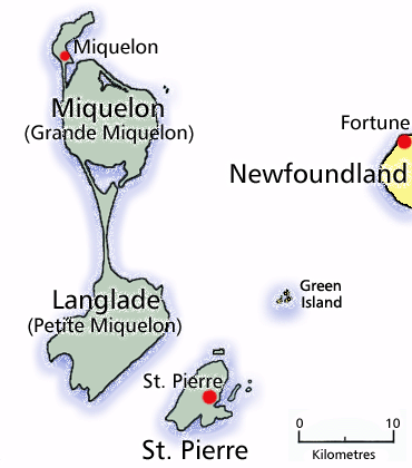
St. Pierre et Miquelon
Map by Tanya Saunders. ©2001 Newfoundland and Labrador Heritage Web
Site.
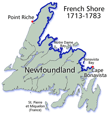
French Shore 1713-1783
Map by Tanya Saunders. ©2001 Newfoundland and Labrador Heritage Web
Site.
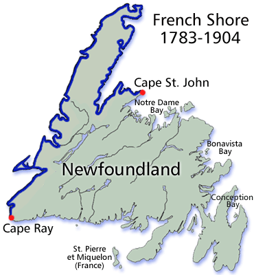
French Shore 1783-1904
Map by Tanya Saunders. ©2001 Newfoundland and Labrador Heritage Web
Site.
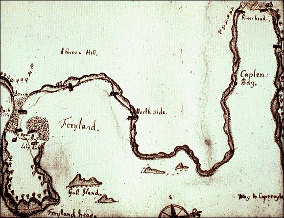
James Yonge's Map of Ferryland, ca. 1663
From F.N.L. Poynter, ed., The Journal of James Yonge, 1647-1721, Plymouth Surgeon (London: Longman, Green & Co. Ltd., ©1963) Plate 4 A: "Part of the coast of Newfoundland, showing Ferryland", facing 81.
Government and Politics
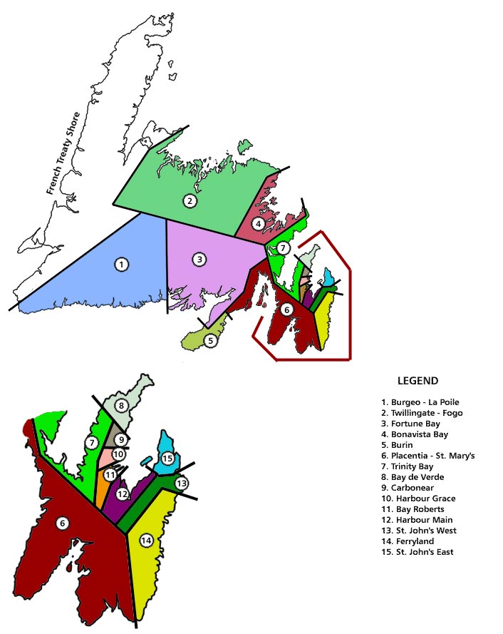
Newfoundland Electoral Boundaries for the 1869 Election
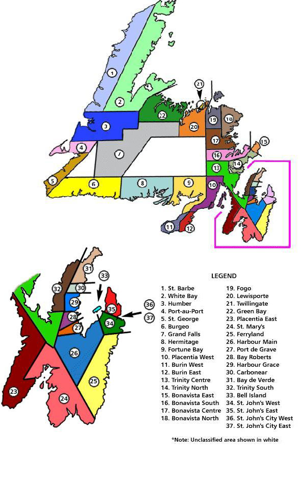
Newfoundland Electoral Boundaries for the 1946 National Convention
Illustration by Duleepa Wijayawardhana, 1998. Based on research by Matt Dwyer from the The National Convention Act, 1946.
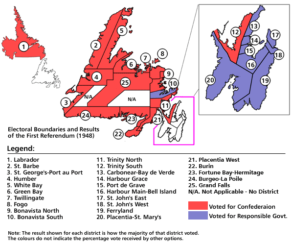
Electoral Boundaries and Results of the First Referendum, 1948
Illustration by Duleepa Wijayawardhana, 1999.
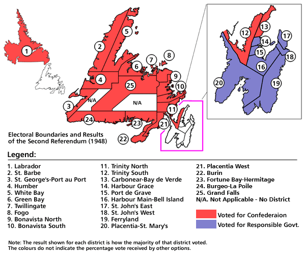
Electoral Boundaries and Results of the Second Referendum, 1948
Illustration by Duleepa Wijayawardhana, 1999. Based on research by Christine King and Vince Walsh.
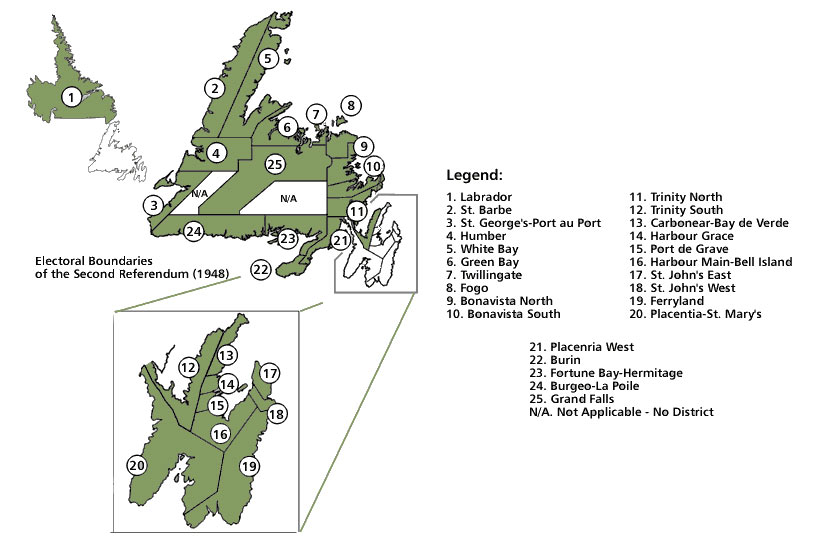
Electoral Boundaries of the Second Referendum, 1948
Labrador Boundary Dispute
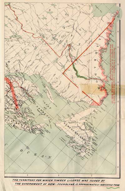
Map Indicating Territory for which License Granted by Newfoundland
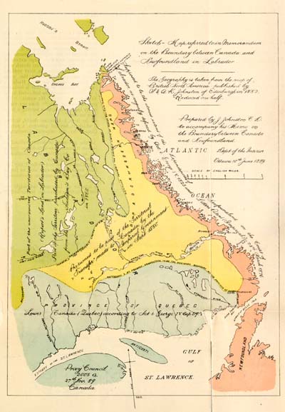
Sketch Map Prepared by J. Johnston
Map Showing Bench Marks Established in the Narrows in 1923 by the Geodetic Survey of Canada
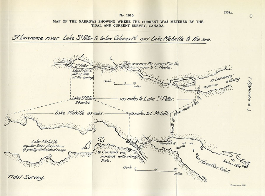
Map of the Narrows Showing where the Current Was Metered by the Tidal and Current Survey, Canada
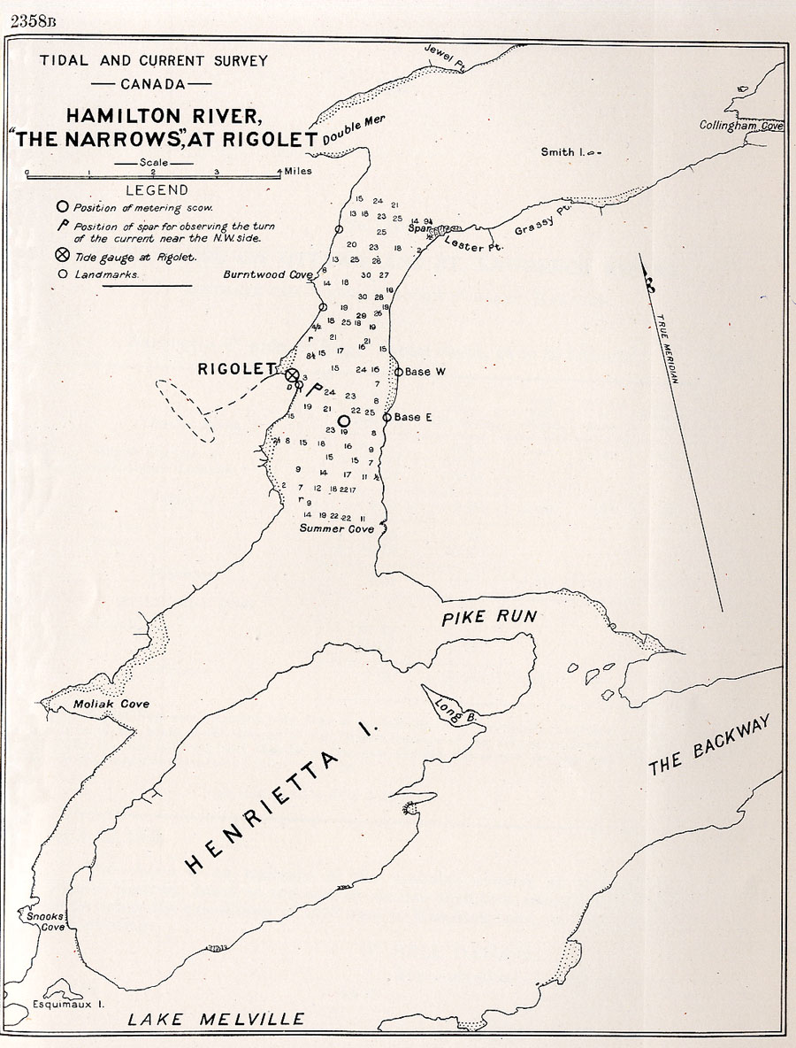
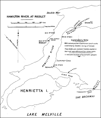
Hamilton River, 'The Narrows', at Rigolet
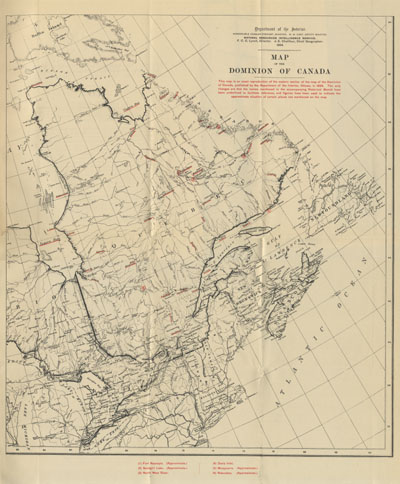
Map of the Dominion of Canada
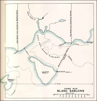
Sketch Map Illustrating Rival Contentions of Canada and Newfoundland
