Map Index: Illustrative maps in articles (main project)
Page 3


Exploration and Settlement
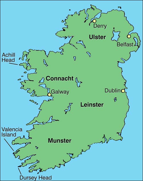
Ireland: The Various Headlands from which Cabot Possibly Began his Atlantic Crossing
Illustration by Duleepa Wijayawardhana, 1997.
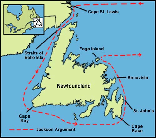
Cabot Map #1: The Jackson Northern Landfall Argument
Illustration by Duleepa Wijayawardhana, 1997.
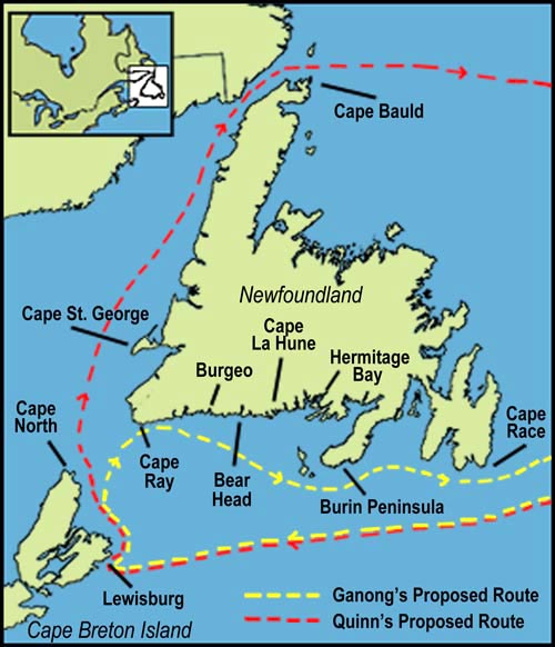
Cabot Map #2: The Routes Proposed by Ganong and Quinn
Illustration by Duleepa Wijayawardhana, 1997.
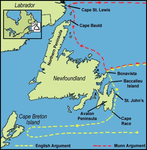
Cabot Map #3: The Routes Argued by English and Munn
Illustration by Duleepa Wijayawardhana, 1997.
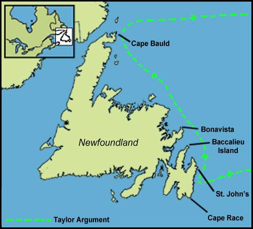
Cabot Map #4: The Taylor Newfoundland Landfall Argument
Illustration by Duleepa Wijayawardhana, 1997.
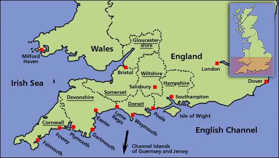
The English West Country
Illustration by Duleepa Wijayawardhana, 1998. Based on research by Wendy Churchill.
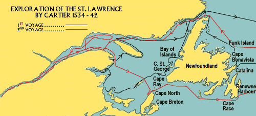
Exploration of the St. Lawrence by Cartier 1534-42
From Lawrence J. Burpee, ed., An Historical Atlas of Canada (New York: Thomas Nelson and Sons, Limited, 1927) 5. Map by John Bartholomew & Son, Ltd., Edinburgh Geographical Institute. Modified by Tina Riche.
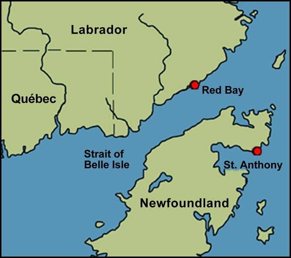
Red Bay in the Strait of Belle Isle
Illustration by Duleepa Wijayawardhana, 1997.
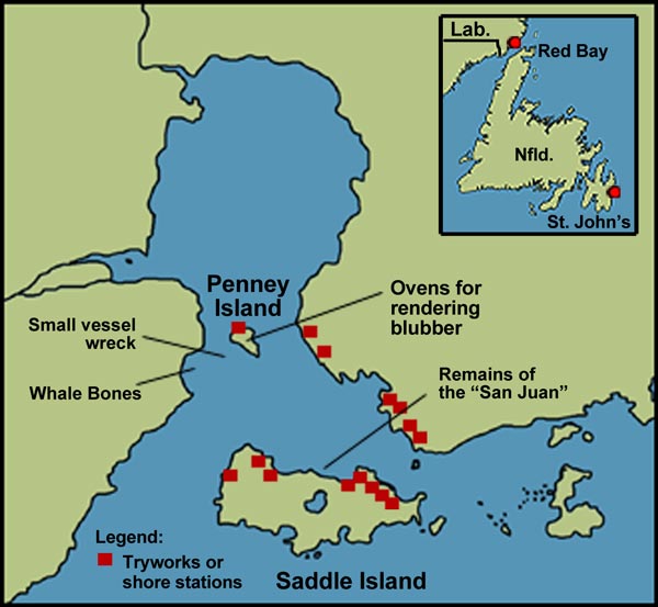
Red Bay, Labrador
Illustration by Duleepa Wijayawardhana, 1997.
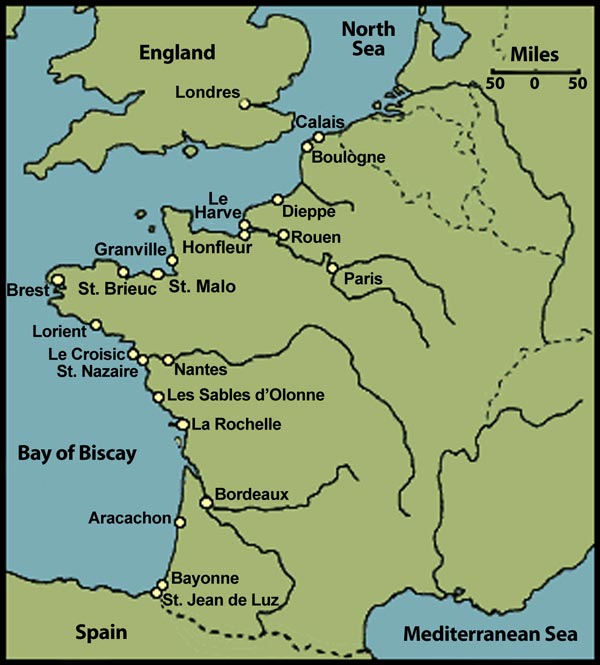
French Atlantic Fishing Ports
Illustration by Tina Riche, 1997.
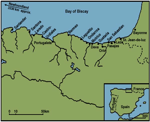
Southern European Markets
Illustration by Tina Riche, 1997.
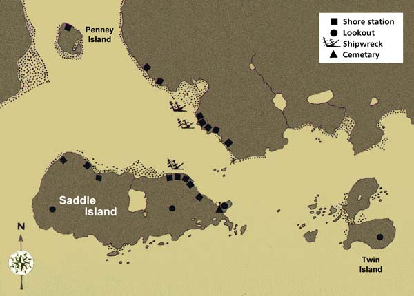
Red Bay Harbour, Labrador
Adapted by Duleepa Wijayawardhana with permission, 1998. Adapted and reproduced by permission of J.A. Tuck, Atlantic Archaeology Ltd. From James A. Tuck and Robert Grenier, Red Bay, Labrador: World Whaling Capital A.D. 1550-1600 (St. John's, Newfoundland: Atlantic Archaeology Ltd., ©1989) 38.
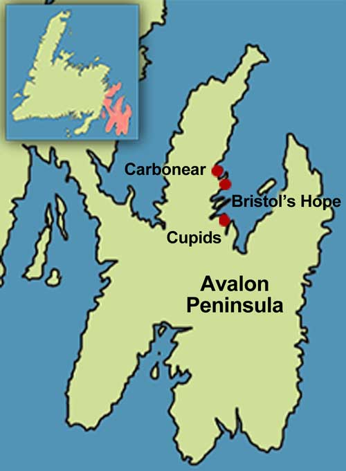
Avalon Peninsula
Illustration by Duleepa Wijayawardhana, 1998.
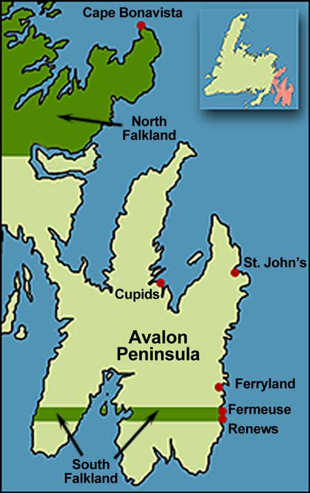
North and South Falkland
Illustration by Duleepa Wijayawardhana, 1998.
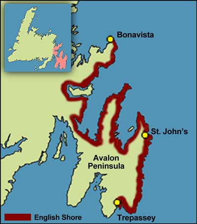
English Shore during the 17th Century
Illustration by Duleepa Wijayawardhana, 1998.
