Map Index: Historical Maps:
Page 2


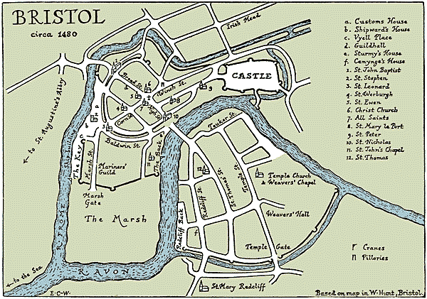
Town of Bristol, ca. 1480
Adapted from a map by E.M. Carus-Wilson in The Merchant
Adventurers of Bristol in the Fifteenth Century (Bristol, England: The Bristol
Branch of the Historical Association, ©1962) which was based on an earlier
map by William Hunt in Bristol, 2nd ed. (London: Longmans, Green, &
Co., 1887).
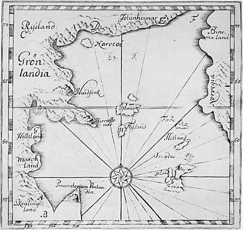
Late 16th Century World Based on Icelandic Writings
Reproduction of Sigurd Stefánsson's 16th century map, published in 1706 by Torfæus from 'Gronlandia Antiqua.' From Jónas Kristjánsson, Icelandic Sagas and Manuscripts (Reykjavik, Iceland: Saga Publishing Co., ©1970) 16.
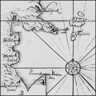
Detail of Late 16th Century World Based on Icelandic Writings
Reproduction of Sigurd Stefánsson's 16th century map, published in 1706 by Torfæus from 'Gronlandia Antiqua.' From Jónas Kristjánsson, Icelandic Sagas and Manuscripts (Reykjavik, Iceland: Saga Publishing Co., ©1970) 16.
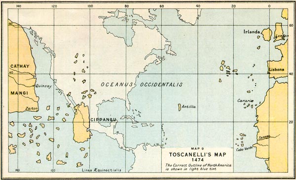
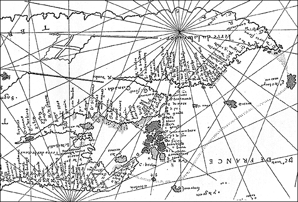
Toscanelli's Map, 1474
From Lawrence J. Burpee, An Historical Atlas of Canada, (Toronto: Thomas Nelson and Son Limited, 1927) 4. Map by John Bartholomew and Son, Ltd., Edinburgh Geographical Institute.
Section of Gerolamo da Verrazzano's Map of the World, 1529
Courtesy of the Vatican Photo Library (Foto Biblioteca Vaticana), Vatican City. From André Vachon, in collaboration with Victorin Chabot and André Desrosiers, Dreams of Empire: Canada before 1700, Records of Our History series, English transl. by John F. Flinn (Ottawa, Ontario: Public Archives of Canada, ©1982) 30. Plate 13.
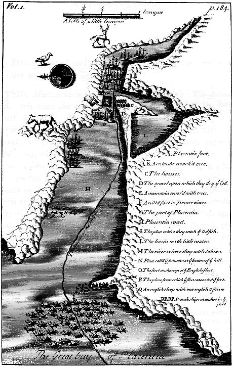
Map of Placentia, 1703
From Baron de Lahontan, New Voyages to North America (Chicago: A. C. McClurg & Co., 1905) 345. Reprinted from the 1703 English edition, includes facsimile of original 1703 map.
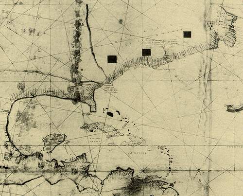
Desliens World Map Showing a Portion of North America, ca. 1541
From Henry Harrisse, Découverte et évolution cartographique de Terre Neuve et des pays circonvoisins 1497-1501-1769: essais de géographie historique et
documentaire (London: Henry Stevens, Son & Stiles, 1900).
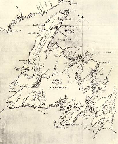
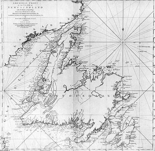
Map of the Island of Newfoundland, 1768
Courtesy of the National Archives of Canada / C-087924. From Peter Neary and
Patrick O'Flaherty, Part of the Main: An Illustrated History of Newfoundland and Labrador
(St. John's, Newfoundland: Breakwater Books, ©1983) 41.
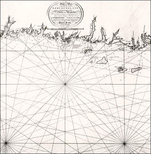
1775 Chart of Newfoundland
Courtesy of the Centre for Newfoundland Studies, Queen Elizabeth II Library, Memorial University of Newfoundland, St. John's NL.
South Coast of Newfoundland
Courtesy of the Centre for Newfoundland Studies, Queen Elizabeth II Library, Memorial University of Newfoundland, St. John's NL.
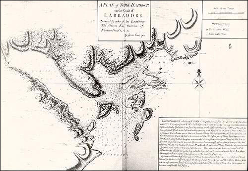
York Harbour, Labrador
Courtesy of the Centre for Newfoundland Studies, Queen Elizabeth II Library, Memorial University of Newfoundland, St. John's NL.
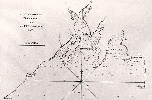
Trepassey, Newfoundland
Courtesy of the Centre for Newfoundland Studies, Queen Elizabeth II Library, Memorial University of Newfoundland, St. John's NL.
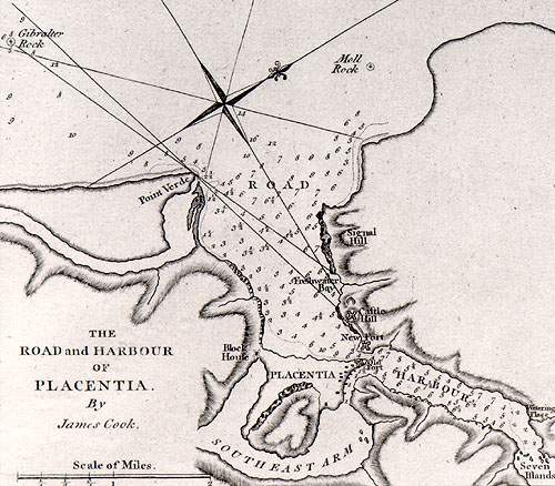
Placentia, Newfoundland
Courtesy of the Centre for Newfoundland Studies, Queen Elizabeth II Library, Memorial University of Newfoundland, St. John's NL.
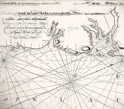
West Coast of Newfoundland
Courtesy of the Centre for Newfoundland Studies, Queen Elizabeth II Library, Memorial University of Newfoundland, St. John's NL.
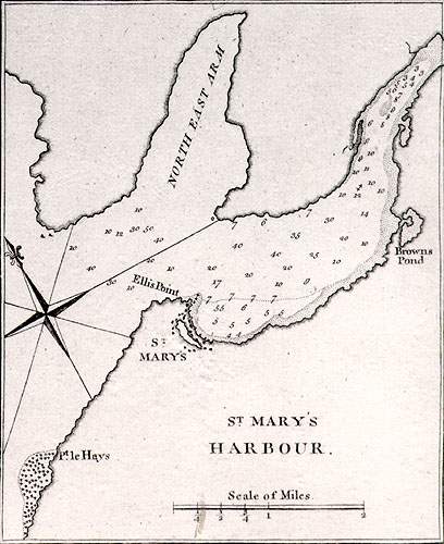
St. Mary's, Newfoundland
Courtesy of the Centre for Newfoundland Studies, Queen Elizabeth II Library, Memorial University of Newfoundland, St. John's NL.
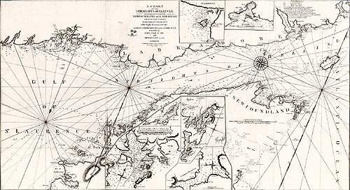
Straits of Belle Isle
Courtesy of the Centre for Newfoundland Studies, Queen Elizabeth II Library, Memorial University of Newfoundland, St. John's NL.
